Skip to content

To the Bahamas: Our First Gulf Stream Crossing

Looking down the port side of a sail boat, with a bow wave cresting off to the left as the boat moves through the blue ocean with a blue sky and white fluffy clouds

To say I was nervous about crossing the Gulf Stream would be an understatement. The only way to get to the Bahamas from the US is to cross the Gulf Stream. Tons of people do it, so why am I all worked up?

My propensity for seasickness and my general risk aversion had me reading all the ways that this crossing could be uncomfortable and potentially dangerous. I read article after article about avoiding a crossing with ANY North wind component. I read post after post on the cruiser forums about people who were blasé about the crossing and people who wouldn’t cross unless it was guaranteed to be completely benign. I had worked myself up into a tizzy.

Anchored at Lake Worth, Florida

On Sunday, 11 February 2024, we arrived at the Turtle Cove anchorage in north Lake Worth, Florida. The 2-day journey down the ICW from Eau Gallie to Ft. Pierce to Lake Worth was uneventful, though I would not recommend traversing Ft. Pierce to West Palm Beach (via ICW) on the weekend. It was a madhouse of weekend boaters (beer in hand), southbound cruisers, yacht deliveries, and sport fishing boats. 
A blue water anchorage with several sailboat anchored out and large houses in the background. A blue sky is above with a few white and grey clouds.
This is just one corner of the anchorage at Turtle Cove. Lots of room for lots of boats.
The Turtle Cove anchorage (North Palm Beach) was a lovely spot with plenty of room for many boats. Within an hour of being anchored, a dinghy approached us, and it was our buddy Danny, who works at East Coast Marine Rigging in Deale, MD, and had done quite a bit of work on our boat last summer. He was prepping to cross to the Bahamas the next evening and wanted to stop by to say hello. What a small world! After much googling, I needed help figuring out where the dinghy beach was. After checking Aquamaps, I noticed a boat right next to us was active on the social feature, so I messaged them with my quandary. They told me where to go and invited us to stop by. What a nice anchorage this is turning out to be! We already know two boats in the area?! I wholeheartedly accepted the positive energy as a salve to my nerves.
Looking down a narrow beach with kayaks on the left, and 2 inflatable dinghies on the right with a road bridge to the right and a fenced area to the left. A creek is beyond the beach
The dinghy beach at Turtle Cove is challenging in that you need to go at low tide or be prepared to get wet.

Planning the Crossing: Weather Routing

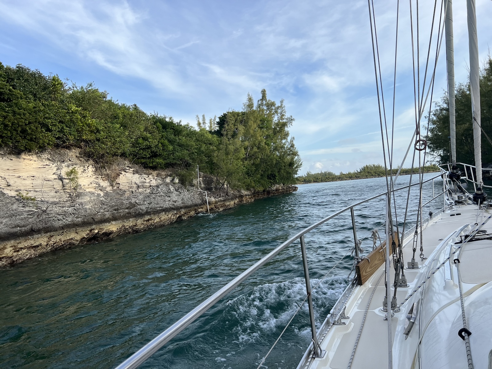
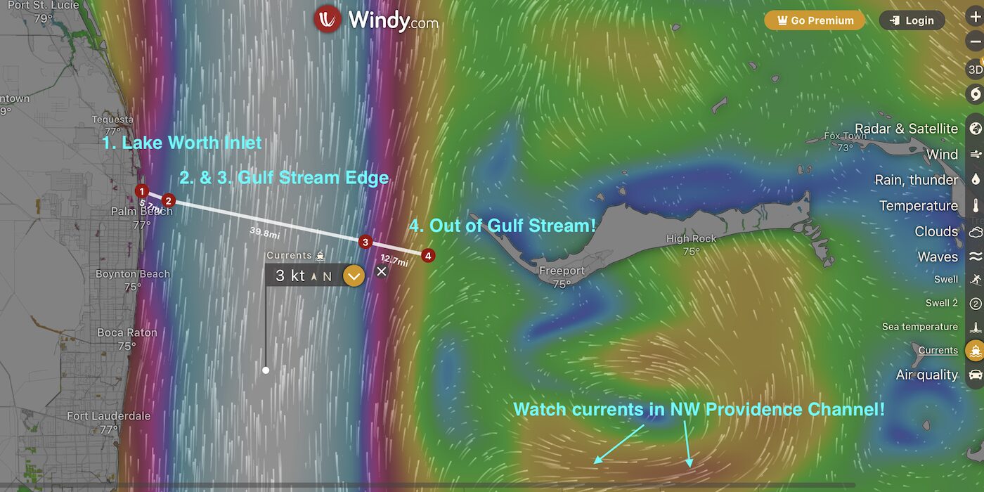
When crossing from Florida to the Bahamas, the shortest routes (distance-wise) are:

  1. North Route: Lake Worth to West End 
  2. South Route: Miami to Bimini 

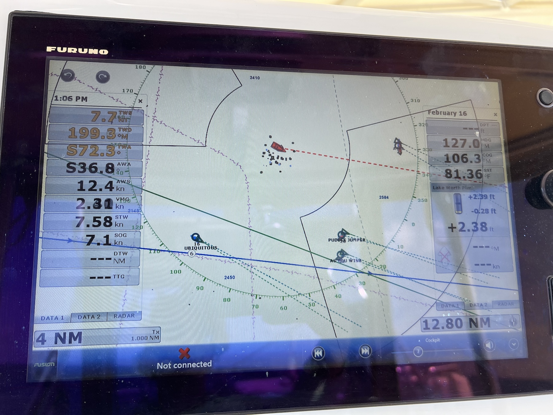
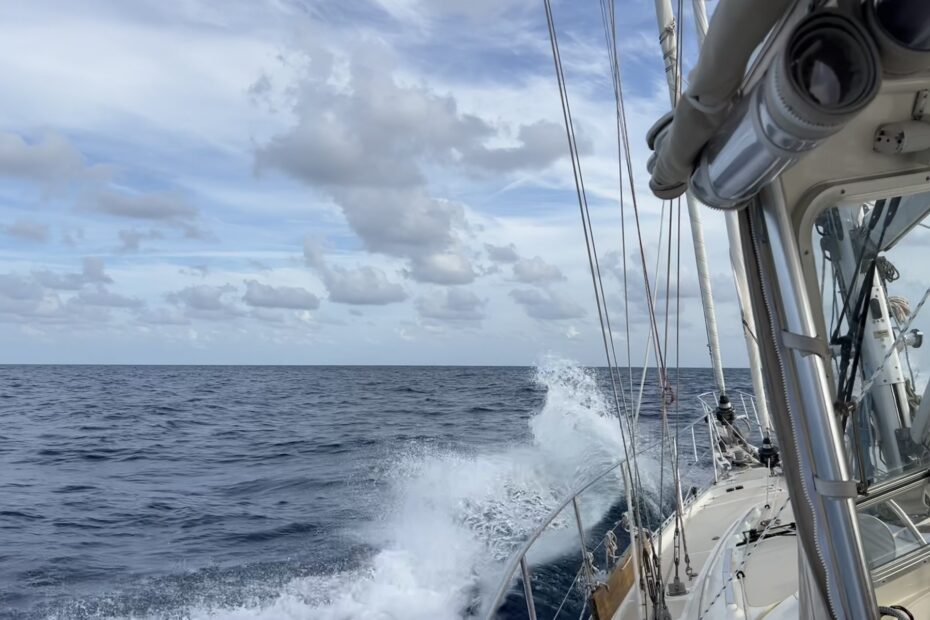
Both options are approximately 45-50nm, a day trip for most boats going across, so this is a single-day event. Having already done several overnight passages, we were up for another overnight to get further into the Bahamas, closer to the common cruising grounds. However, the extended trip meant we needed to look for a larger weather window.  

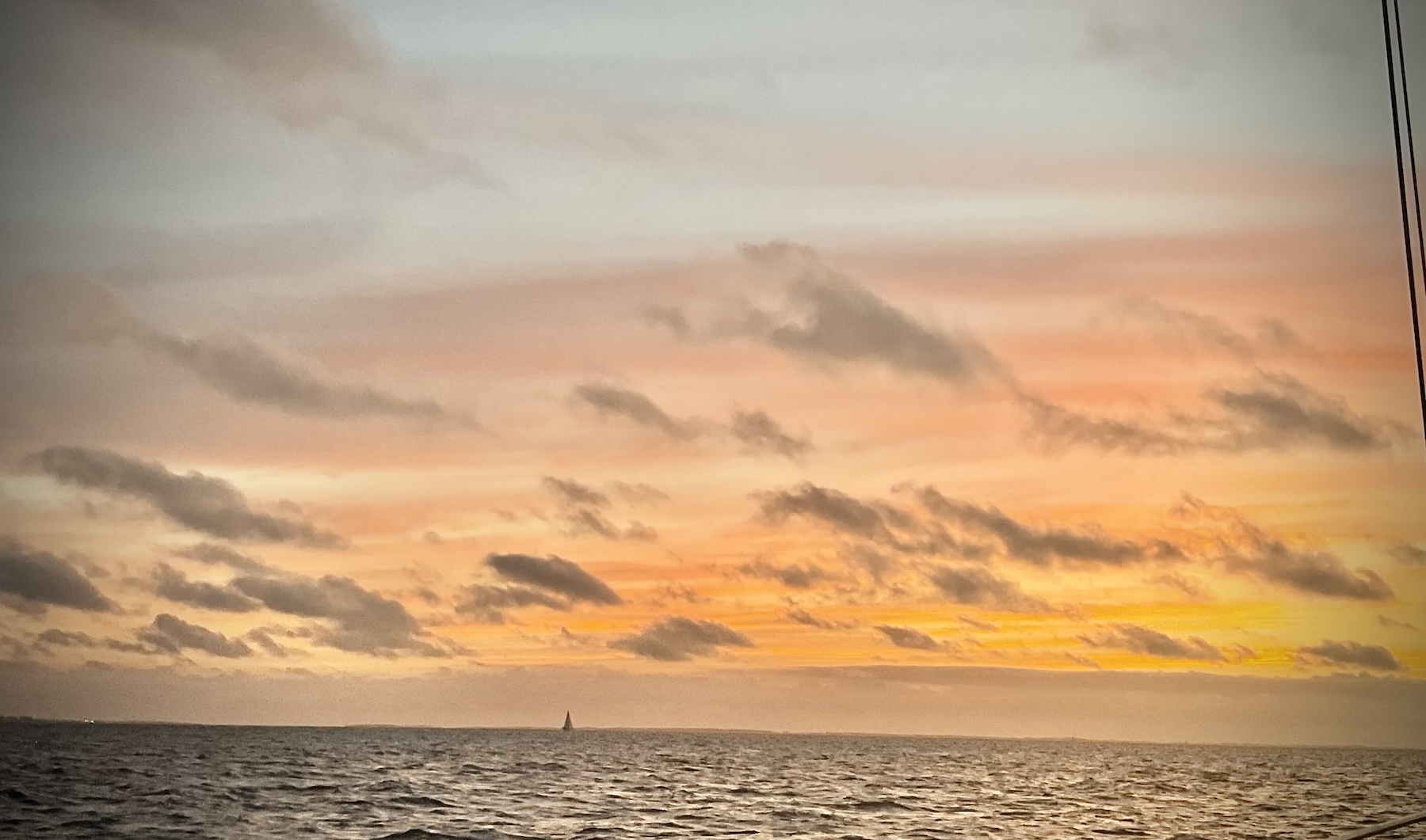
We looked at the weather for a Monday (2/12) night crossing, but a northwest wind made me nervous about the sea state. As with the Beaufort to Charleston trip, we leveraged Chris Parker’s custom Marine Weather routing service and Totem coaching to review the forecasts and potential routes. By Sunday night, Chris Parker’s team described the Monday (2/12) night crossing as “salty.” A good USCG captain friend commented once, “If Chris Parker uses an adjective to describe the weather, I don’t go.” After much deliberation, we opted to pass on the Monday night window, making space for rest and mental preparations.

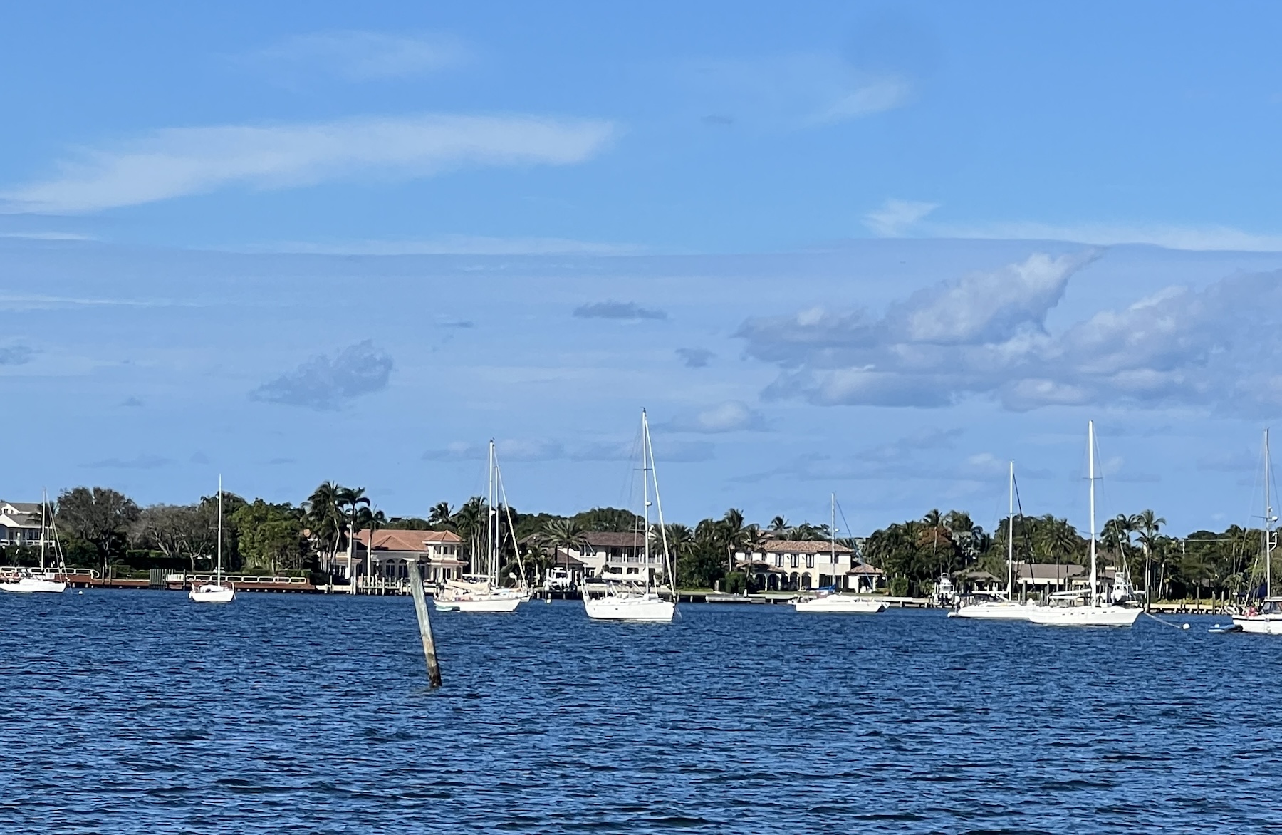
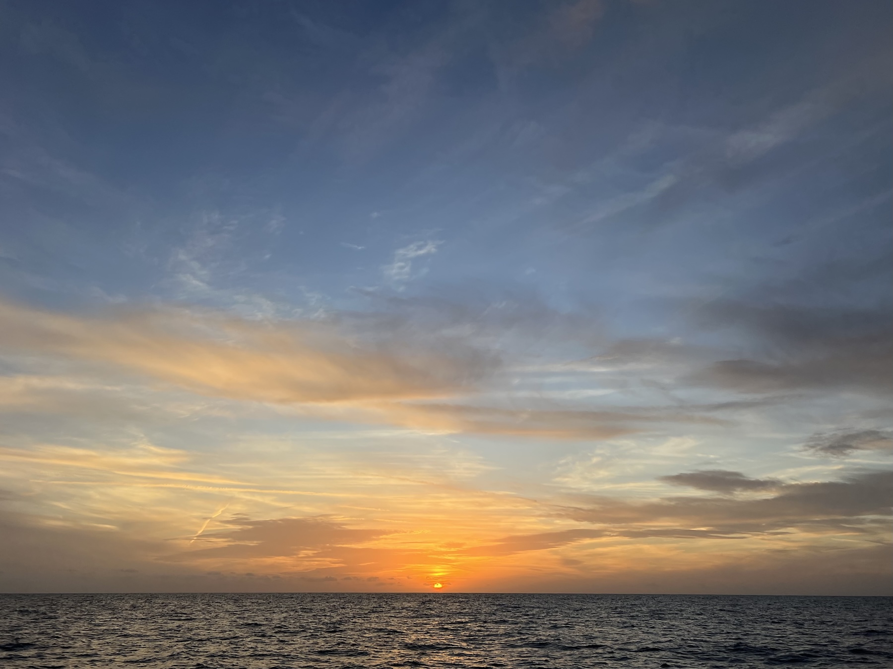
As we continued monitoring the weather, the next best window appeared to open the following Thursday (2/15) or Friday (2/16). In the meantime, we hung out with our new anchorage neighbor, a 49′ Chris White MastFoil catamaran, who’d helped us out on Aquamaps. In addition to those friends, we got to see McCain on MamaDot, our Totem-buddy boat with whom we traveled from Beaufort, NC, to Charleston, SC

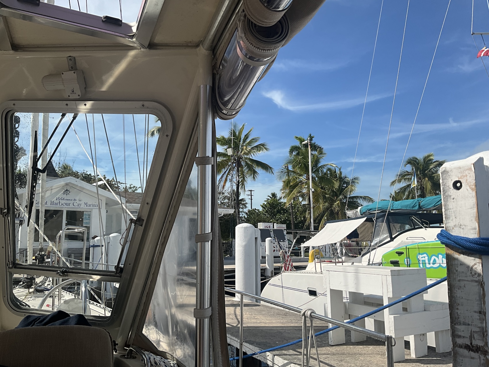
We also got one last State-side dinner at Paris in Town, a cute French cafe within walking distance of the dinghy beach. The savory crepes were to die for, and the macarons made for a perfect finishing touch. We were getting amped, and I was working through my anxiety in order not to be overwhelmed by it.

Thursday, 15 February 2024: Decision Time

We met with Jamie and Behan (Totem) on Thursday (2/15) to review the weather and passage plan. By then, it looked positive that we would leave Friday for a 24-hour passage to Great Harbour Cay in the Berry Islands of the Bahamas. The only remaining question was Friday morning or Friday afternoon departure, which, by the end of the day, we decided Friday morning. Thus, we prepared the cabin for our trip (the deck was still in order from previous journeys). That meant putting all our stuff away, securing items that might fall over/make a mess, and stuffing paper towel rolls into the cabinets with dishes so they’d make less racket jangling around while underway (a lesson from our first passage).

We also had to:

  • take out the trash, 
  • top off fuel, 
  • pump out our holding tank, and 
  • top off our water tanks. 

We weighed anchor and headed to a nearby marina to complete those tasks. Once finished, we came back to spend one last night in lovely Turtle Cove. It was nearly time to leave!

Friday, 16 February 2024: Let's Go!

The 6:30am alarm awakens us to an excited energy. Today’s the day we leave the US with our floating home! The day starts with the usual passage rituals of coffee, meditation, and deck checks. As we’ve done these checks, we have become more efficient in going about them. We log tank levels, check the engine oil, check cotter pins on the rigging, and many other items that ensure we are prepared for an ocean passage. We will share our pre-departure rituals in more depth in a future post.

By 8:15am, we weighed anchor and headed south to the Lake Worth inlet to begin our gulf stream crossing. We timed our departure to coincide with optimal tides and currents since Lake Worth’s inlet can get raucous when the wind goes against the current. Our fellow Totem-cruisers, Sailing Meraviglia, had just arrived in Lake Worth from their epic 2-day journey and waved us out of the inlet. What a special, unexpected treat!

Looking out across the boat of a sailboat with sails furled, blue ocean is calm ahead, as the boat exits an inlet
This is what the Lake Worth Inlet looks like right after high tide. It was quite calm.

At 9am, we exited Lake Worth inlet and sailed out into the wild, blue yonder! Sailed? Hah. No. We motored. Because we were headed directly into the wind (what little there was). Someone said to us recently, “[The amount of motoring] is a dirty little secret in the cruising world.” No worries, though. We had one goal: get across the Gulf Stream as quickly as possible and then worry about how much sailing we were or were not doing once we were in the Bahamas.

It’s difficult to say exactly when we entered the Gulf Stream (maybe 10 or 11am?), but it was relatively quick, given that the maps show it hanging only a few miles off the Palm Beach shore.

A screenshot of a map from windy showing the current in grey between the east coast of florida and the bahamas. There are annotations showing the distances across the gulf stream, 3-4mi from florida to the west edge, 38mi across, 3-4mi to the bahamas edge of the stream.
Windy has a great visual aid to show where the Gulf Stream current roughly is. Annotations are mine.

There are several ways to navigate this crossing, and we opted to take Jamie’s advice and navigate our best heading by feel. That meant pointing east, checking our speed, and then pointing south, 10 degrees at a time until we lost speed. That’s where the current is working against us the most. Then we pointed up to get back up a few degrees to the best eastbound speed and maintained that heading until we exited the Gulf Stream (about 6-7 hours later). The idea was to point as far south as possible to counter the north-flowing current (which carries the boat northward) without fighting directly against the current. This strategy worked well for us.

We had the wind on the nose and motor-sailed across the gulf stream, using the mainsail to bolster the iron sail (the engine). It was a gorgeous ride across Prussian blue waters with negligible wind-chop and some swell to our portside stern. As we traveled, I was satisfied with the window we picked. I used the Scopolamine patch and my ReliefBand for the journey to avoid seasickness, which worked exceptionally well. I wasn’t even a little nauseous. Woo hoo!

A tiny orange sun sets far across a vast blue ocean with faint clouds in shades of pink and orange as the sky fades to a dark blue
This is about the time we exited the gulf stream on Friday night.

We exited the Gulf Stream around sunset, 6:30pm, on Friday (not far from West End, which was one of our bailouts) and prepped for our night watch rotation. After some discussion, we opted for 4-hour watch cycles because that is a full 3 hours of sleep plus some time to do other tasks such as checking the oil or other chores required when transitioning between watches.  

Charlie took the first watch, 7-11pm, and I headed below to sleep as best as possible. With the motor running, it was challenging, but headphones with quiet music playing helped a lot. 

A Rough Patch

At 10:45pm, my alarm went off, but I was already awake. The boat rolled around in a tossing-and-turning motion, which made walking to and using the toilet challenging. Periodically, the bow bashed loudly into a wave. Something had changed while I was asleep.

I donned my PFD (life jackets are called Personal Flotation Devices) and harness (we require clipping in from dusk to dawn) and prepped to relieve Charlie. The boat’s motion became even more unsteady as I alighted the companionway. It was rocking to-and-fo, and Charlie had to vary the throttle to steady the movement. We were in a washing machine of wind against current, and this wasn’t the Gulf Stream! We had miscalculated the impact of the current in the Northwest Providence Channel and the bit of easterly wind we were getting. That made for a very uncomfortable ride.

Charlie was frustrated and exhausted. After discussing a few tactics, I sent him down below to get some sleep. My goal was to make the ride as smooth as possible so he could get sleep while still making progress to get us out of the rough water.

Fortunately, we had been in similar conditions on one of our rougher passages on the Chesapeake Bay (another ill-planned journey). The difference was I couldn’t see the waves coming in the dark. I tried to steer by hand, thinking autopilot might be too “after the fact” in its movements. But that was even worse. I re-engaged Johnny-Five (our autopilot, the 3rd crew member) and continued to vary the throttle, sometimes dropping it to clutched-in to avoid bashing into another big wave.

A night shot of Pinky, with wild curley hair and making a peace sign with her fingers. The shot is red hued and she's got a life jacket on.
This was shortly after getting out of the washing machine of the wind-against-current. So relieved!

I tried turning downwind, and we bashed into a wave after a few minutes. I tried turning upwind, and again, after a few minutes, we bashed into another wave. It didn’t matter which direction I pointed, so I pointed as far south as possible (our course out), working the throttle with one hand and holding onto the helm handlebar with the other. I was determined to get us out of this topsy-turvey ride. I couldn’t have the boat going more than 3.5 knots, but at least we were progressing.

Saturday, 17 February 2024: Can We Make It?

Around 2am, I finally noticed we hadn’t had a big, bashing wave in a while. The seas were rough, but we trucked at 4 knots without slowing down to avoid waves. I cautiously increased the throttle to 5 knots and was pleasantly surprised when Loka started cutting through the waves. We had made it through the worst of that portion. Whew! I could finally sit down and take a breather.

Did I mention there were a lot of ships in this channel? 7-10 cruise ships lit up the channel, transporting sleeping cruisers to their next destination. In addition to the cruise ships, several other vessels were making a similar journey to ours, having crossed the Gulf Stream and working their way to a central or eastern portion of the Bahamas. In other words, there was a lot of traffic to watch out for.

A chart plotter screen shows wind data, boat speed, and other metrics on each side, along with showing boats that are nearby on AIS
Several boats show on AIS who are making the same passage

At 3am, Charlie came up after a sub-optimal rest and relieved me of duty. The seas continued to calm down, and I got a little sleep as we made our way towards Great Harbour Cay. Caffeinated with cold brew, Charlie got a glorious sunrise (the best part of the early morning watch) and navigated us into the crystal clear turquoise waters that all Bahamas photos boast. 

By 8am on Saturday, we had arrived! Ding! Level up!

Having studied the charts, we pulled into the Bay of 5 Pirates on the west side of Great Habour Cay and called the Great Harbour Cay Marina to coordinate clearing customs. 

Customs & Immigration

When researching this part of the journey, we found reports of cruisers paying extra fees in addition to the Cruising Permit. According to the Bahamian government, the only customs fee is the cruising permit unless you’re paying someone to drive you to the customs office. Thus, finding a reputable location for check-in was vital, and Great Harbour Cay Marina had an excellent reputation. 

A view from inside the cockpit of a docked sailboat looking out a a marina with other boats and palm trees against a clear blue sky. The sign over the marina office says "Welcome to Great Harbour Cay Marina"
The Great Harbour Cay Marina office as seen from the cockpit of Loka

To my surprise, Customs & Immigration (C&I) staff had to drive from the other side of the island. Now, I know this is quite common across the Bahamas. In some ports, you have to get a ride (taxi or pay a local) to the airport to meet with C&I. Being at the marina, the marina staff called the C&I staff to come out and helped us verify we had all the documents we needed. They even provided the immigration forms that we did not have. It took about two hours to amass enough people (another 7 or 8 boats came in after us) and for the customs officers to arrive, at which point we stood in line to be processed. Customs & Immigration was very straightforward with our cruising permit, immigration forms, and passports ready, and it took only 5 minutes to complete.

And that was it! We were now cleared and ready to go adventuring throughout the Bahamas! Well…except for some weather coming the next day, of course. That meant we could anchor in the Bay of 5 Pirates and relax/recharge for the next adventures.

We were happy with our weather routing and our decision-making. Besides the washing machine portion, we did well in evaluating the passage plan. And we certainly did well in completing the journey without incident. Another successful voyage in the books!

A clear blue sky is dotted with 2 white fluffy clouds as you look over some bushes below you across a teal and turquoise blue bay with boats anchored in the distance
A view from the north side of the anchorage where it's very shallow (and where the village is)

Journey Stats

Total Distance

148 nautical miles

Duration

24
hours

Average Speed

6.1 knots

Wildlife

Lots of flying fish, no dolphins this time

Pukes

0 - Pinky wasn't even a little sick thanks to Scopalamine

5 thoughts on “To the Bahamas: Our First Gulf Stream Crossing”

  1. Such a great post! Loved hearing the details of your journey and so glad we got to wave you out of the inlet! Excited to hear more of your continued adventures!

  2. I didn’t realize crossing the Gulf Stream could be so involved, but it sounds like the prep paid off until you reached the channel current which seemed the more challenging part. I’m imagining myself on the adventure whenever I read your posts and it all sounds so exciting! You mention a future post will cover pre-departure rituals; that sounds interesting to me and the kind of technical detail type post folks like myself would enjoy.

    Have fun in the Bahamas!

  3. Pingback: Sunset Over The Gulf Stream 16 Feb 2024 – SV Loka

Leave a Reply

Your email address will not be published. Required fields are marked *

This site uses Akismet to reduce spam. Learn how your comment data is processed.